

Each service is offered independently or as part of a full design-to-documentation package, tailored to your project's scope and timeline.
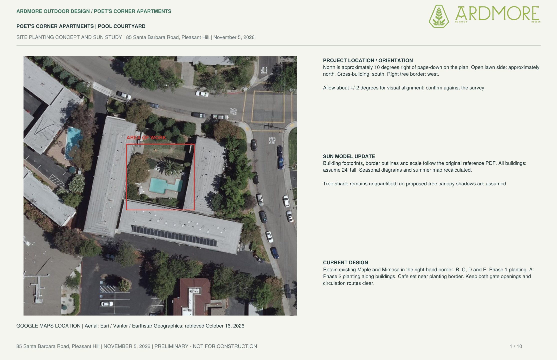
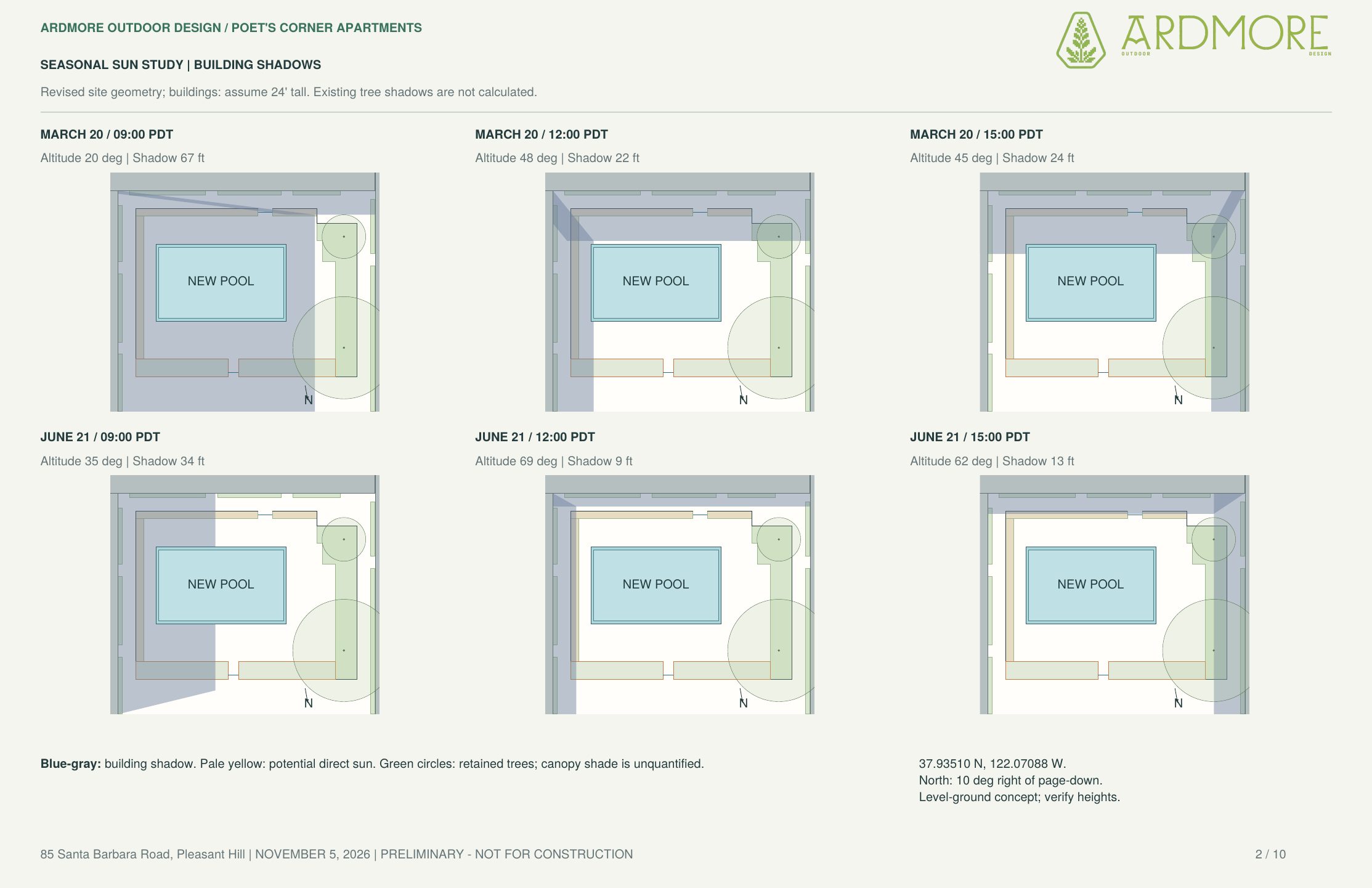
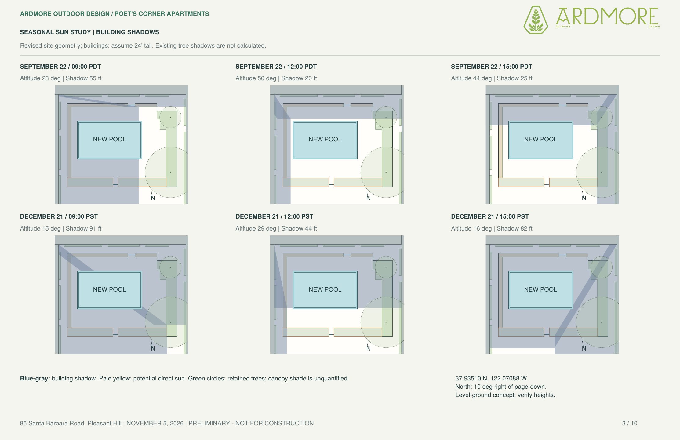
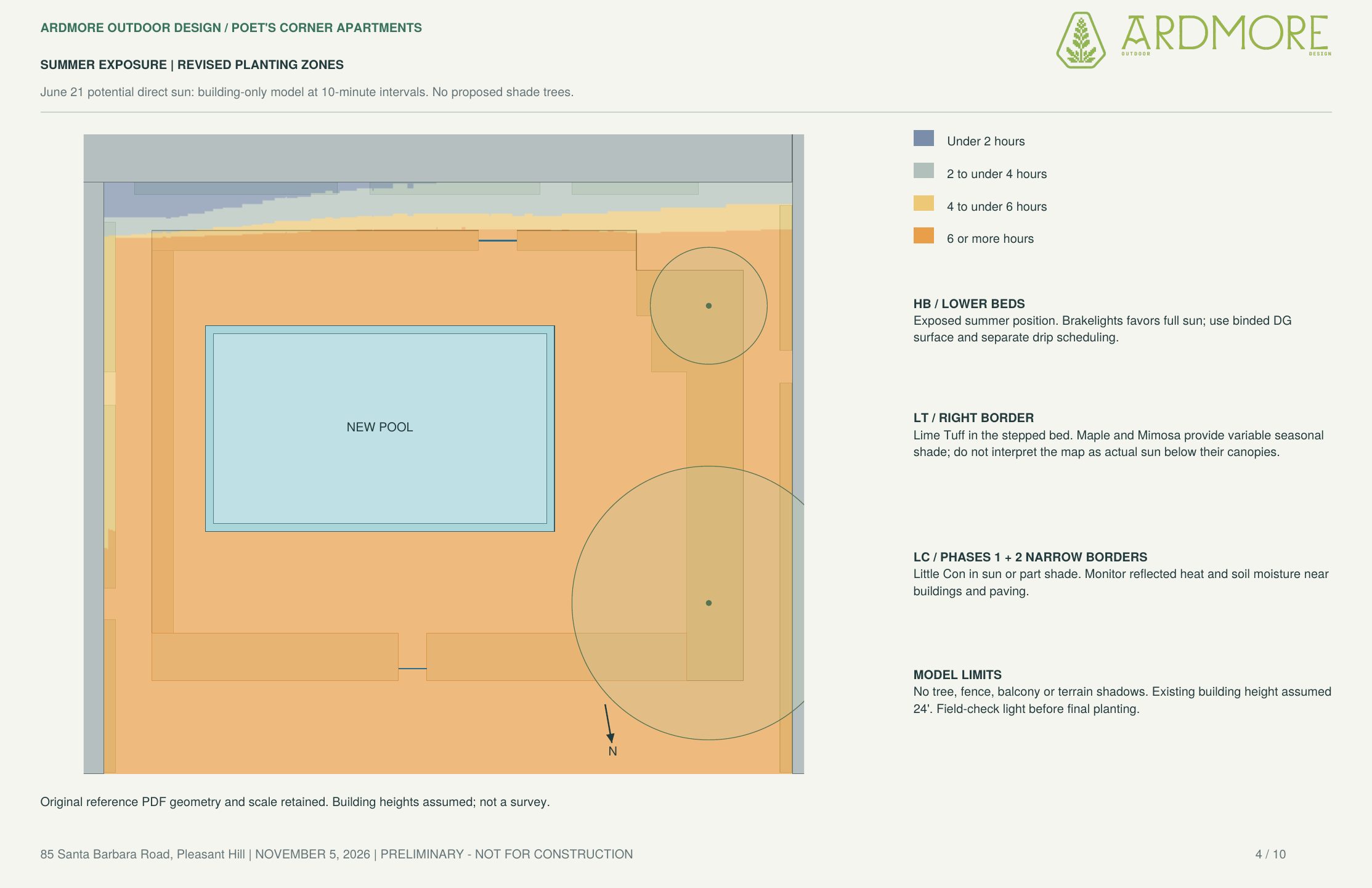
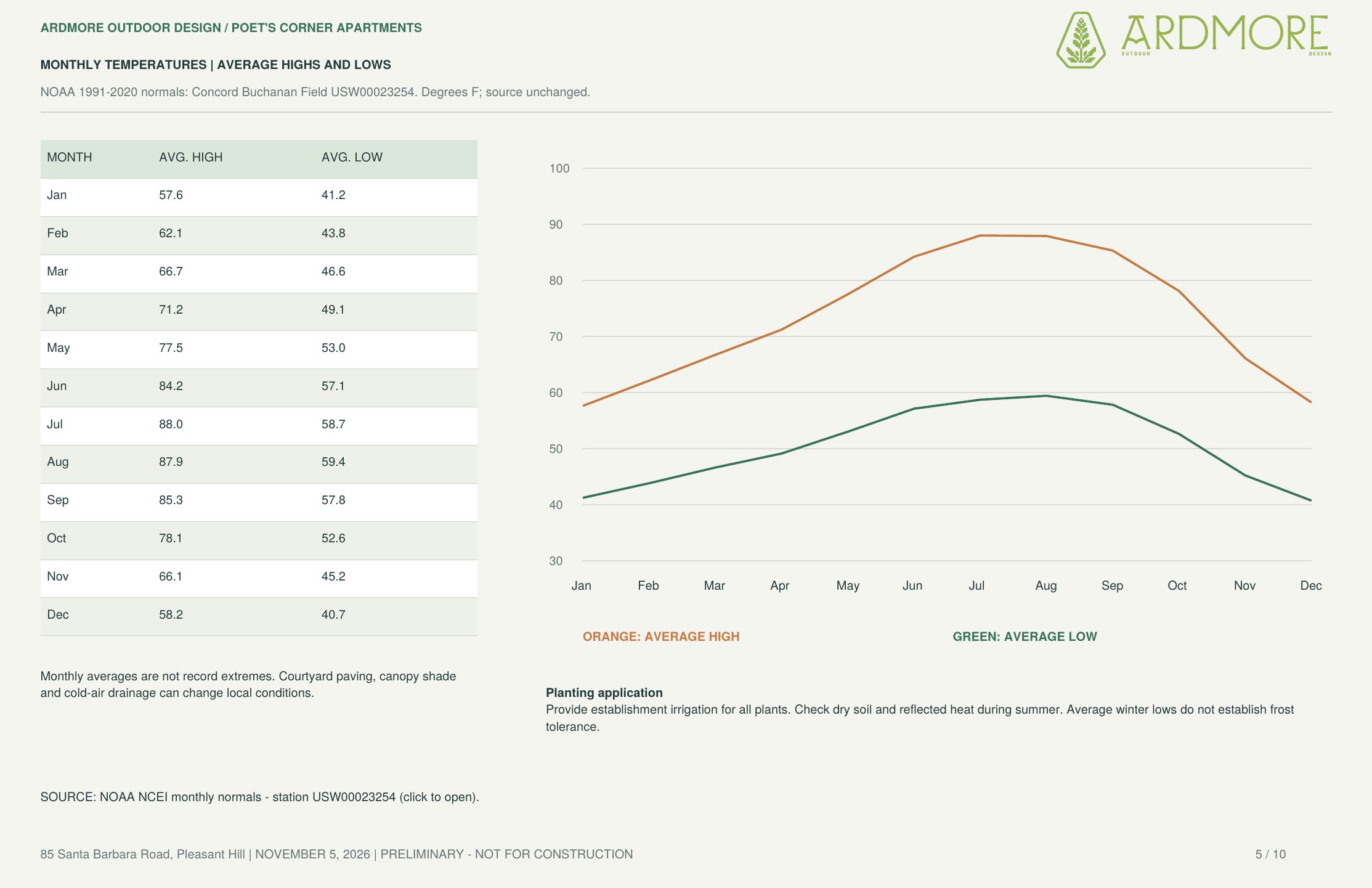
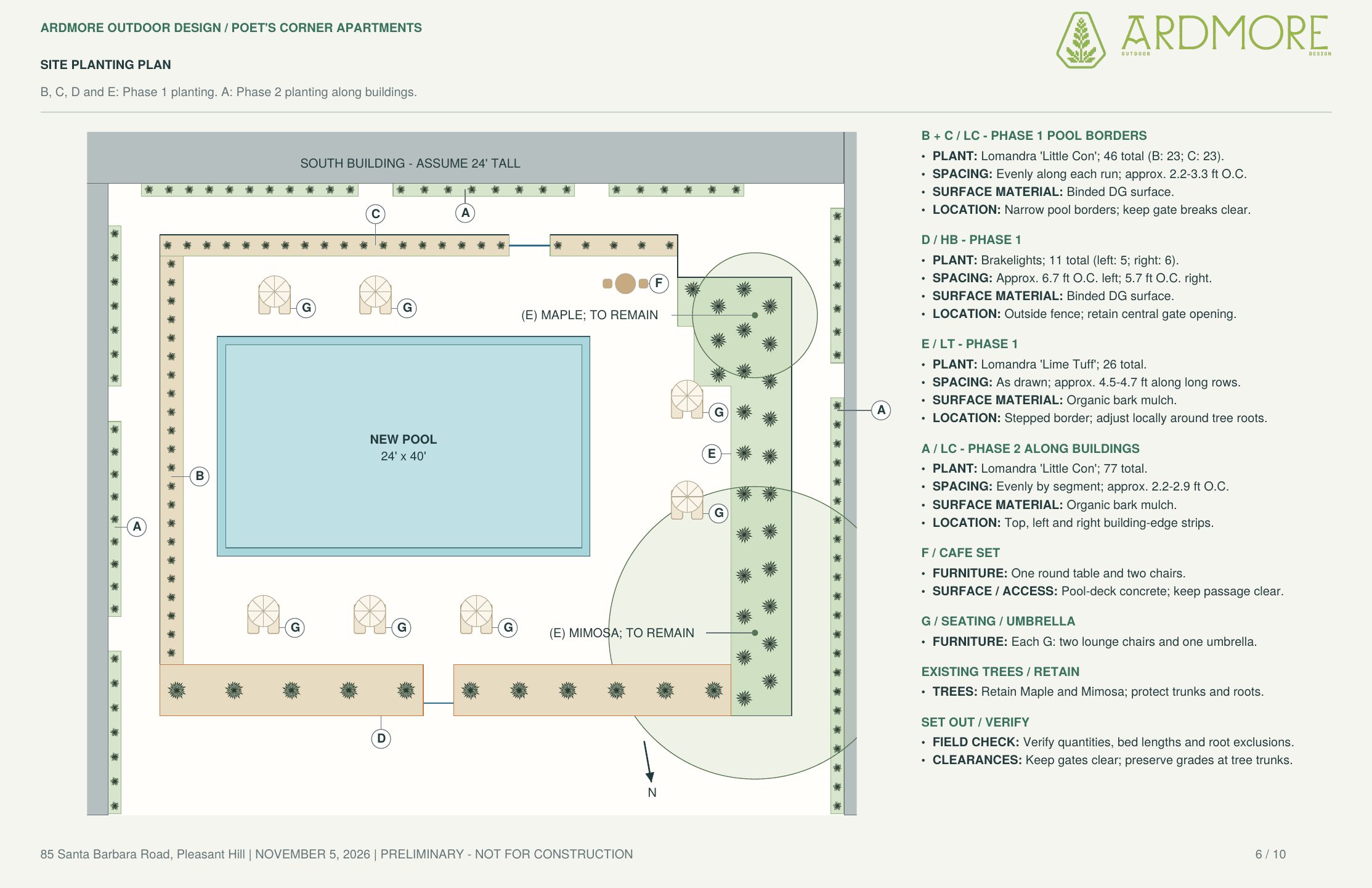
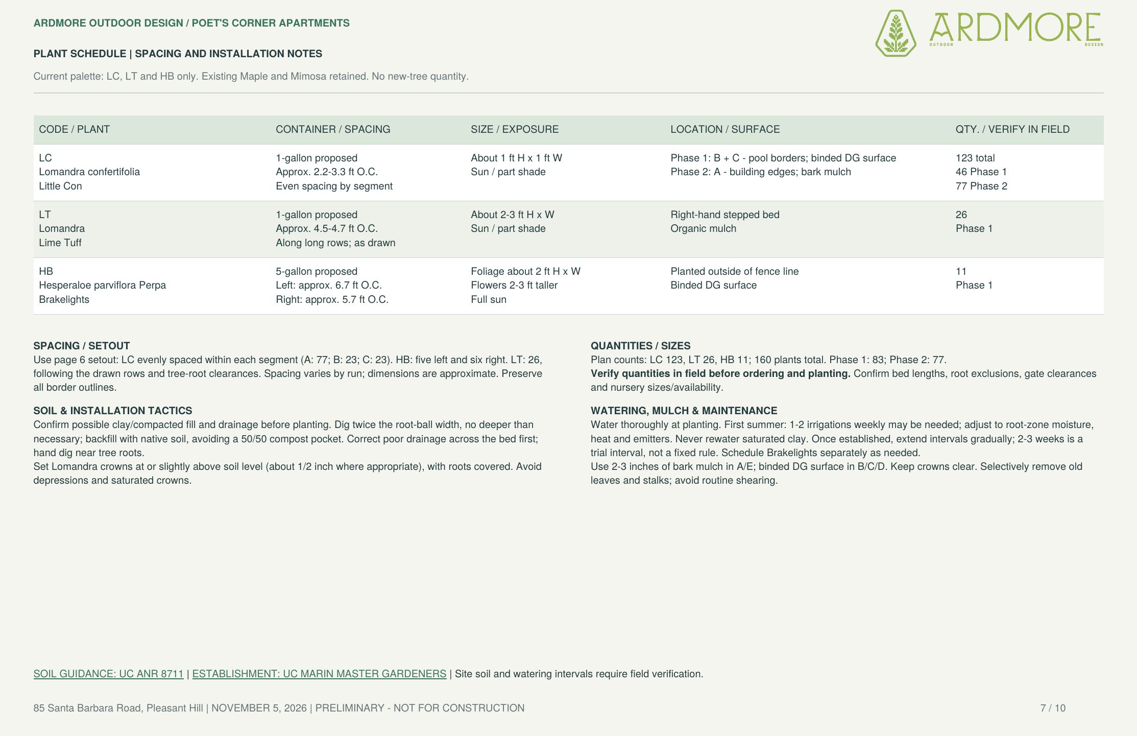
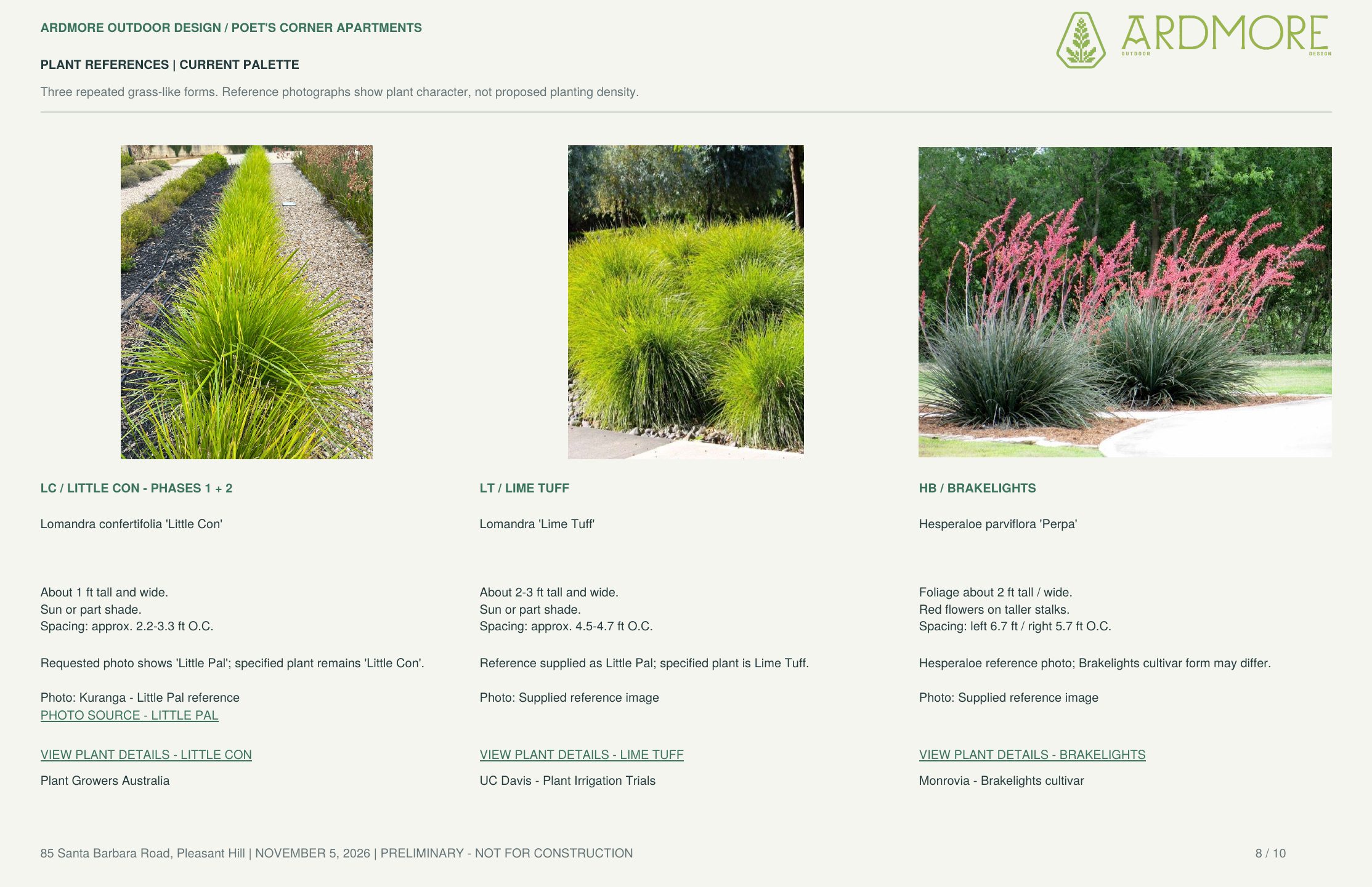
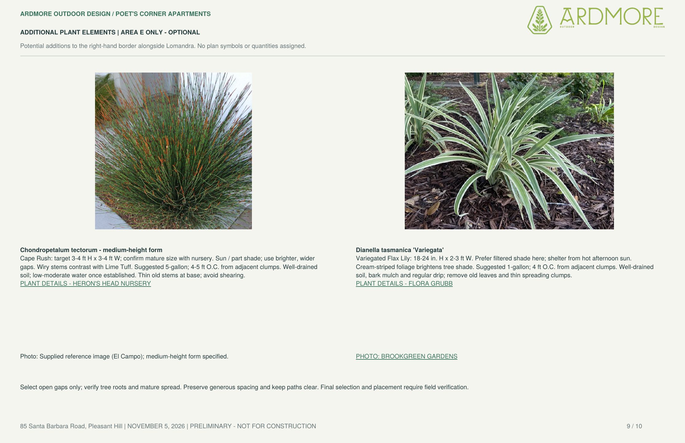
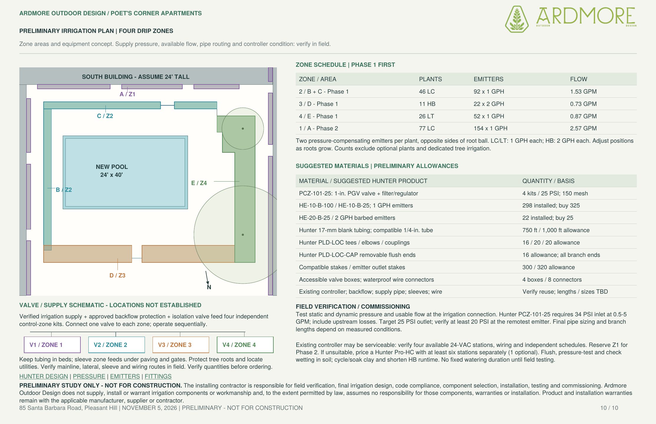
Poet's Corner, Pleasant Hill — planting concept, sun study, planting plan and irrigation. Swipe or use the arrows; tap a sheet to enlarge.
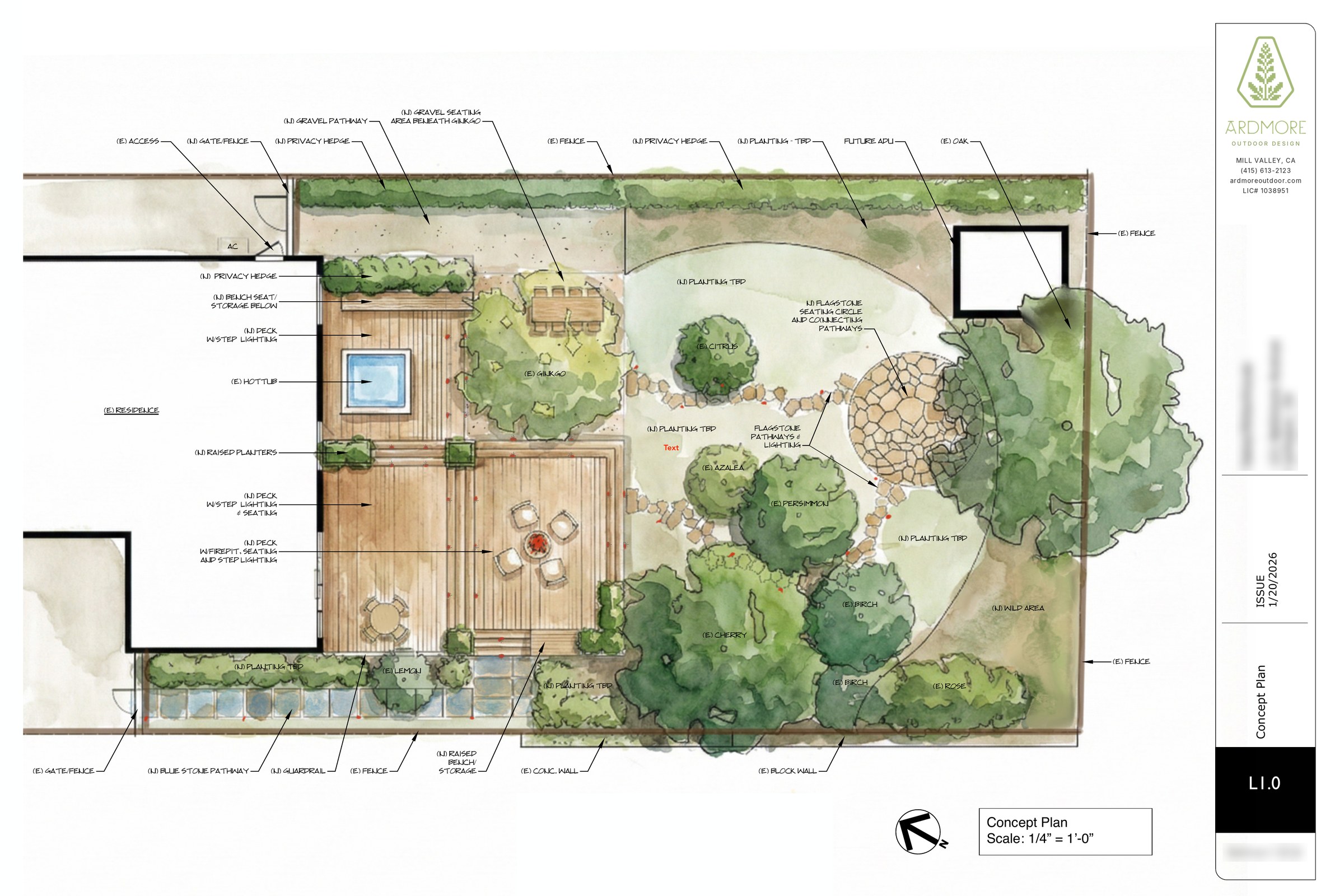
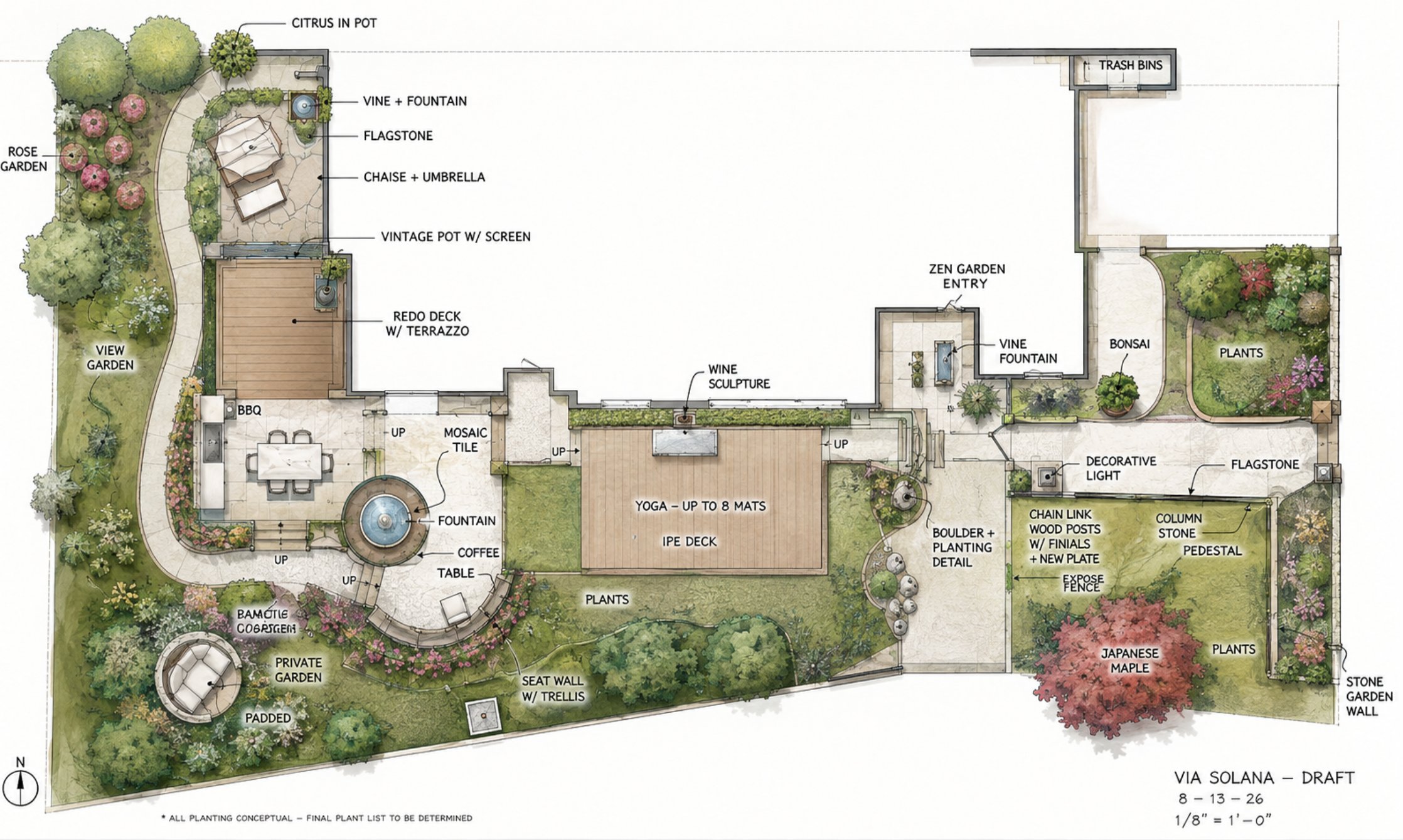
We develop planting, hardscape, and spatial concepts tailored to how you actually want to use your outdoor space — balancing beauty, function, and long-term maintenance.
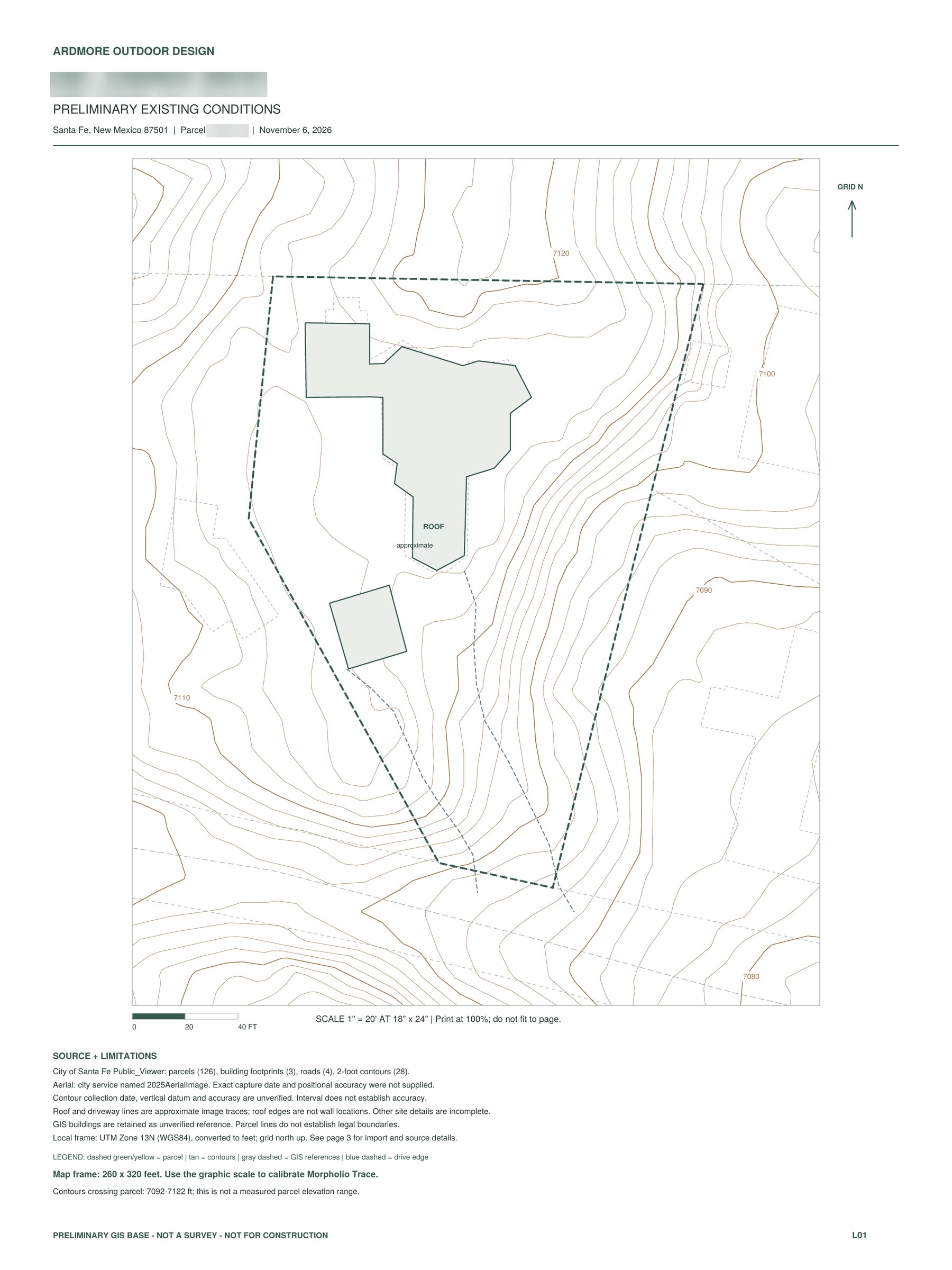
Before you commit to a full survey, we can build a preliminary site base from GIS data — parcel lines, 2-foot contours, building footprints and aerial imagery. It is enough to test ideas and spot constraints early, and it shows whether the project needs a survey, and what kind. A GIS base is a planning tool, not a survey.
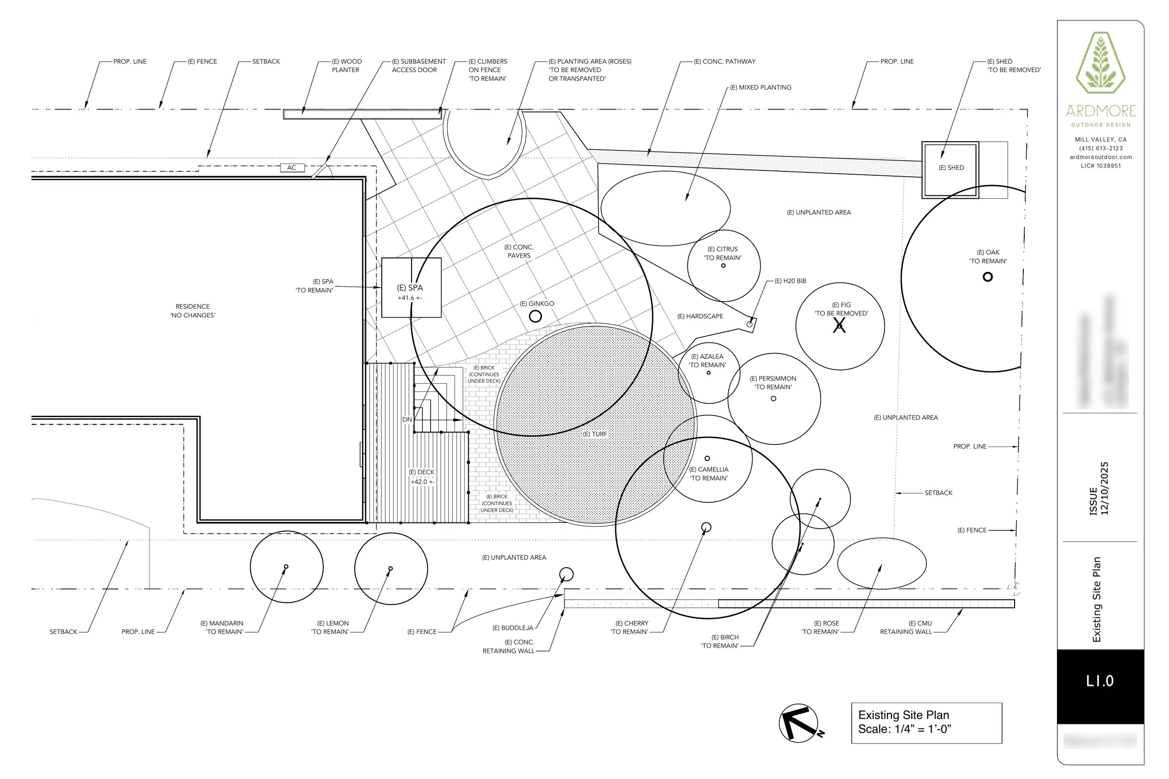
Existing site plan, Larkspur — property lines, setbacks, and every tree and structure to remain or remove. Tap to enlarge.
We work through grading, circulation, and layout constraints early — and coordinate with a licensed civil engineer on drainage design as needed — so the plan that follows is buildable and code-aware from the start.
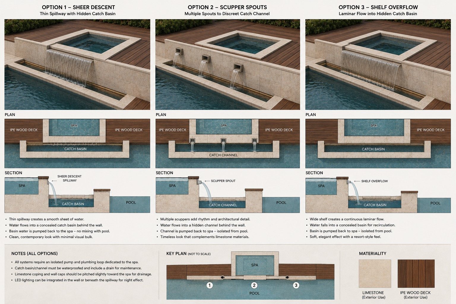
Precise, dimensioned drawing sets that contractors can bid and build from directly — including layout, basic grading, planting, irrigation, and detail sheets.
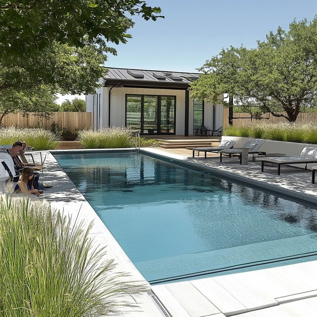
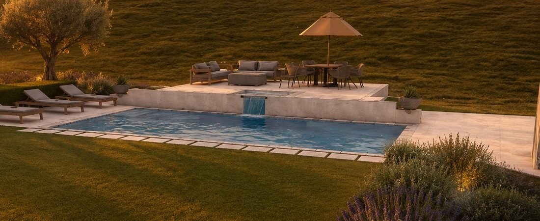
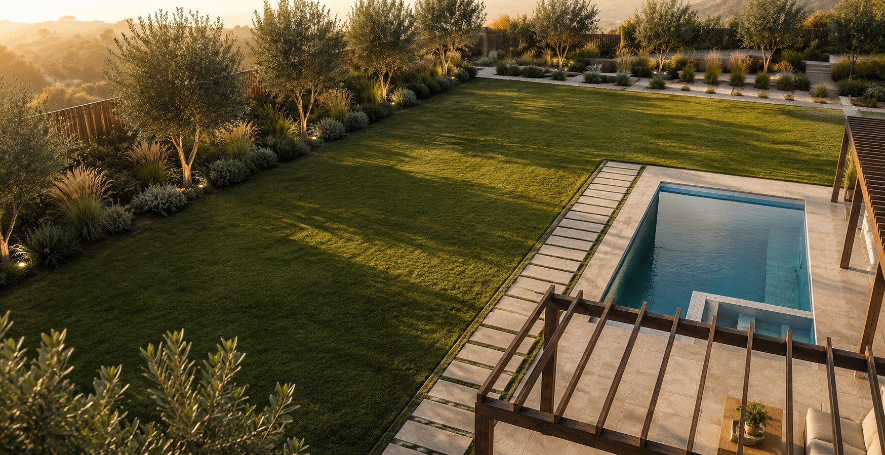
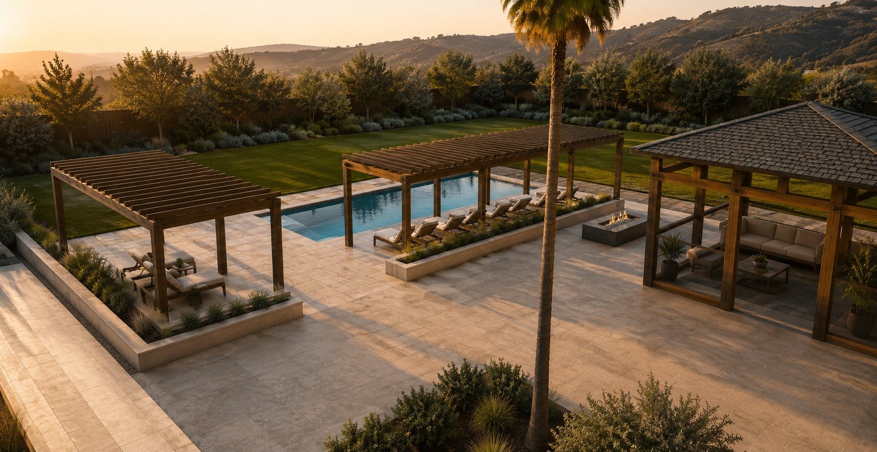
Photorealistic and technical visualizations that help you, your team, and reviewing agencies clearly understand the design before construction begins.
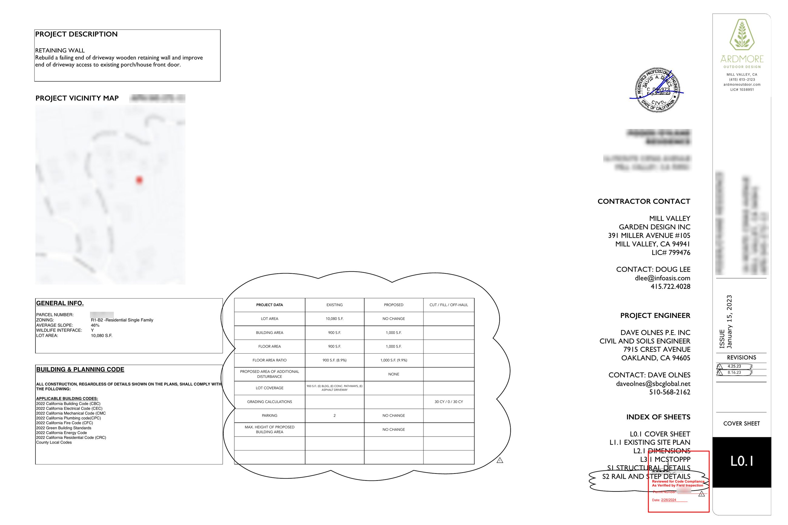
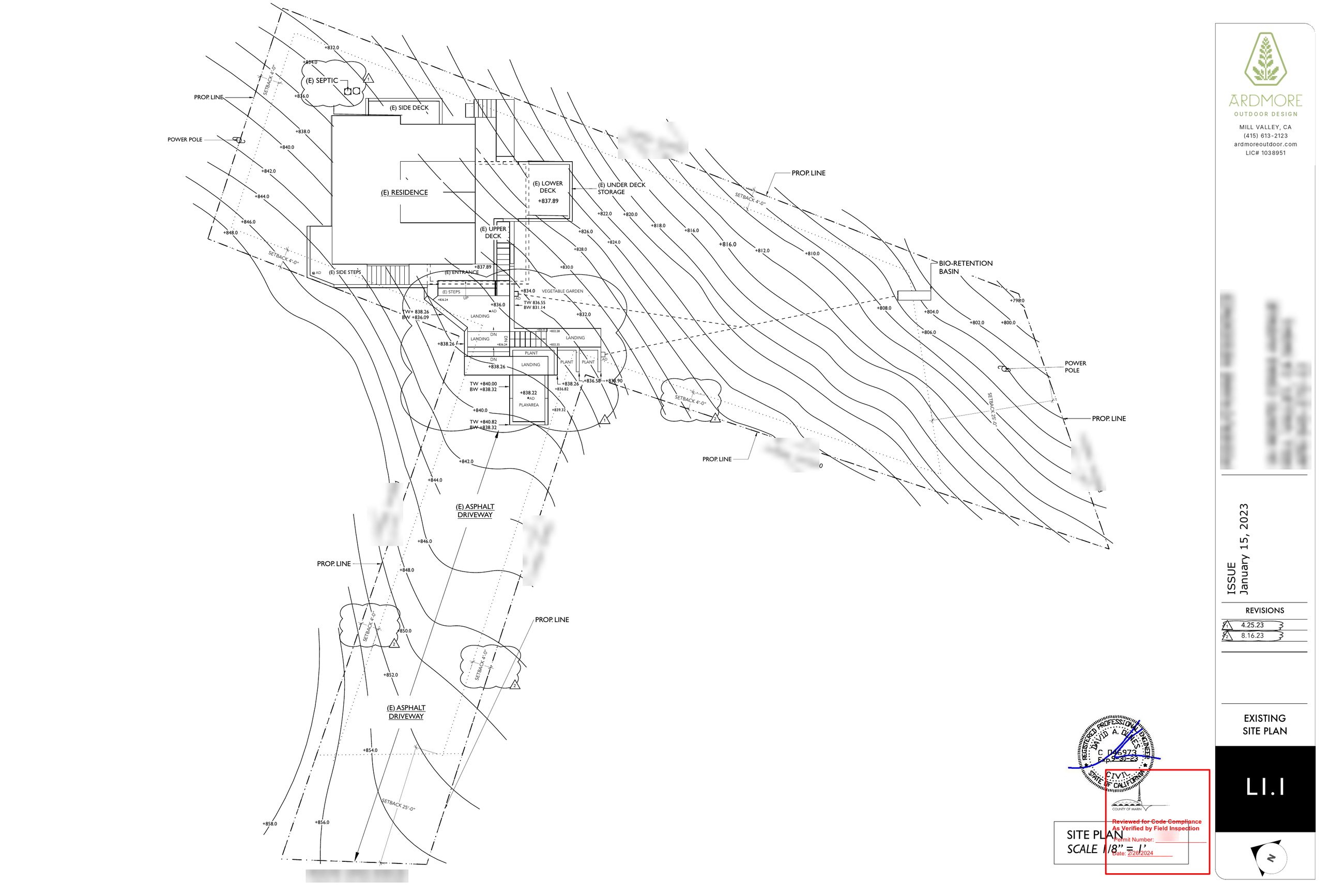
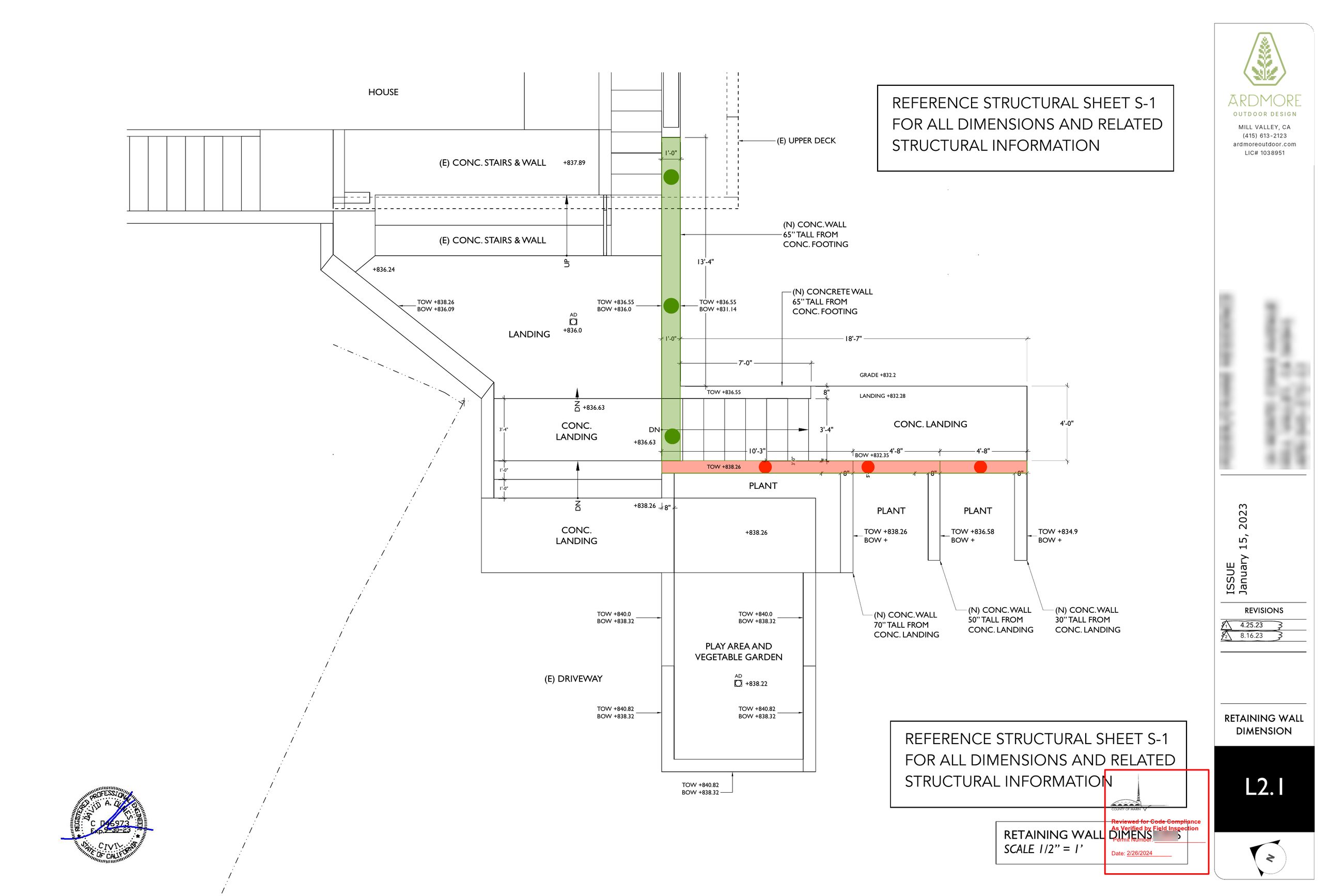
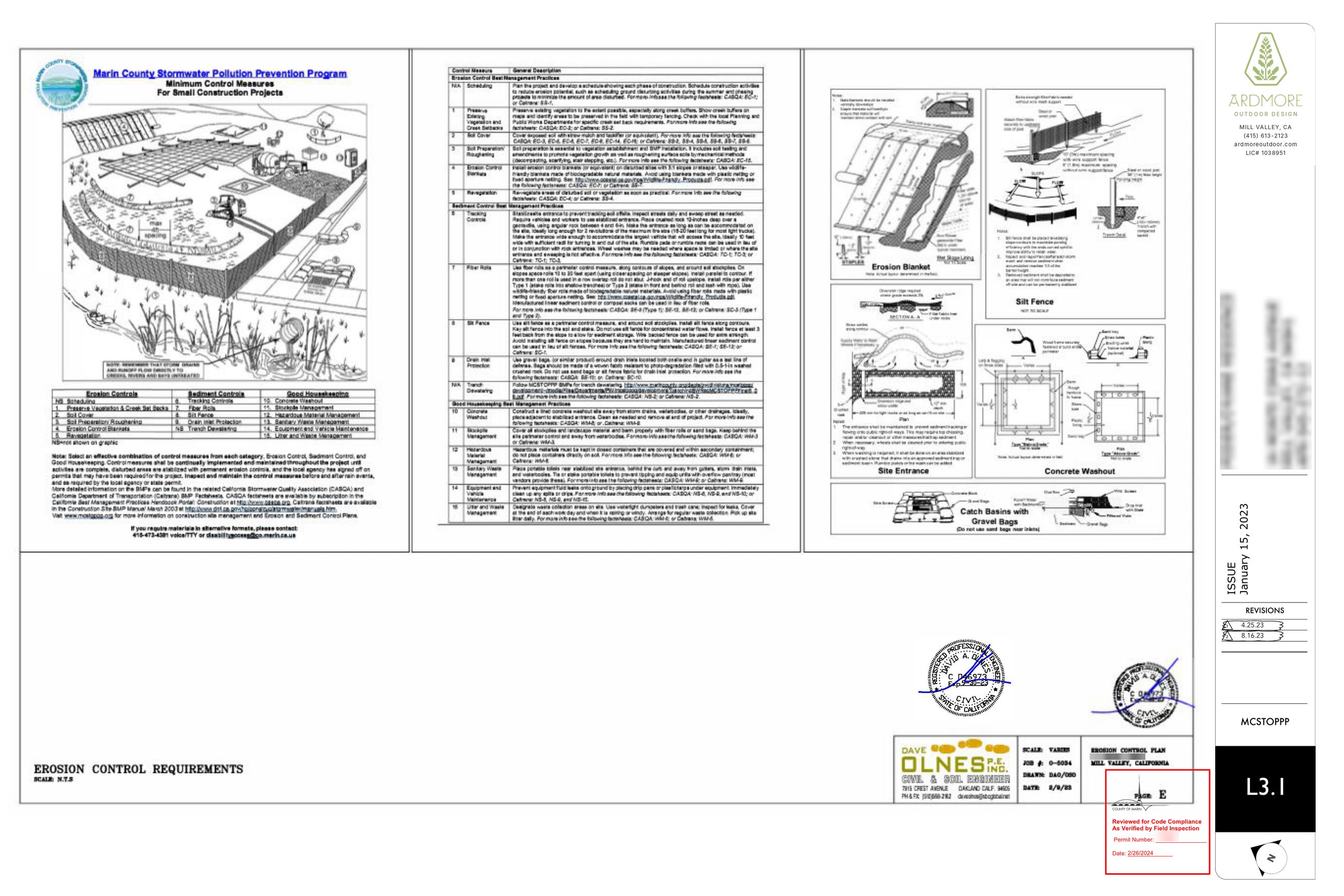
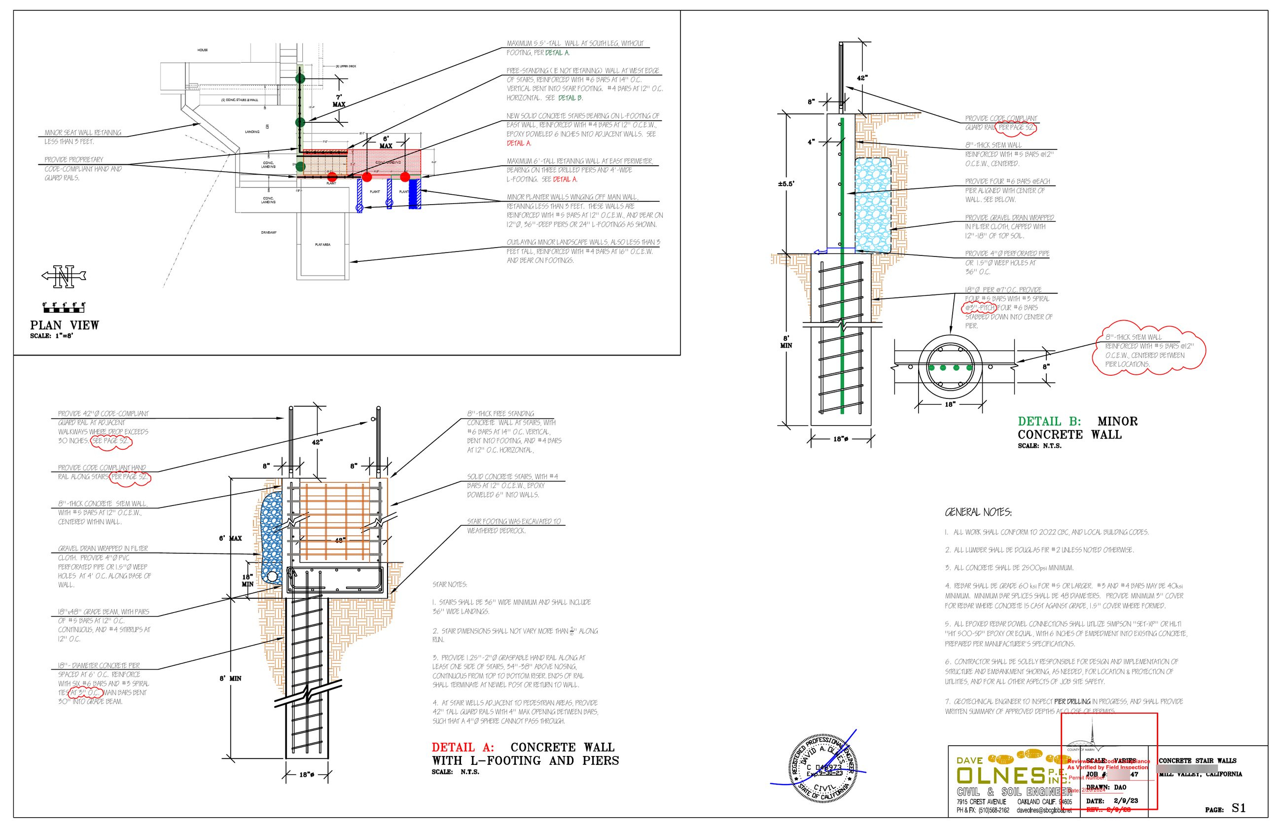
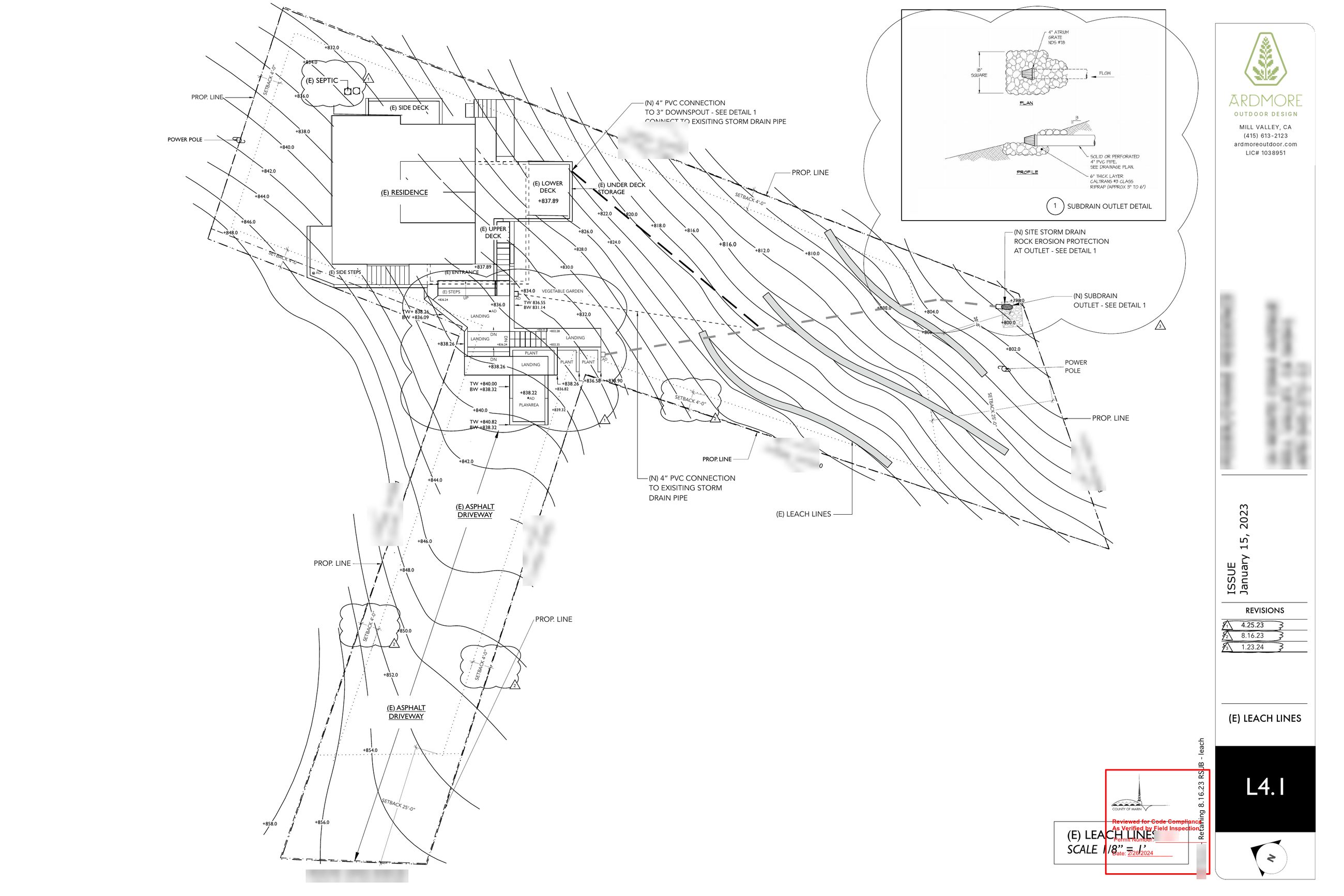
Retaining wall rebuild, Mill Valley — permit set reviewed for code compliance by the County of Marin. Swipe or use the arrows; tap a sheet to enlarge.
We assemble complete, jurisdiction-specific packages — drawings, narratives, and forms — formatted to meet the requirements of your local planning department.
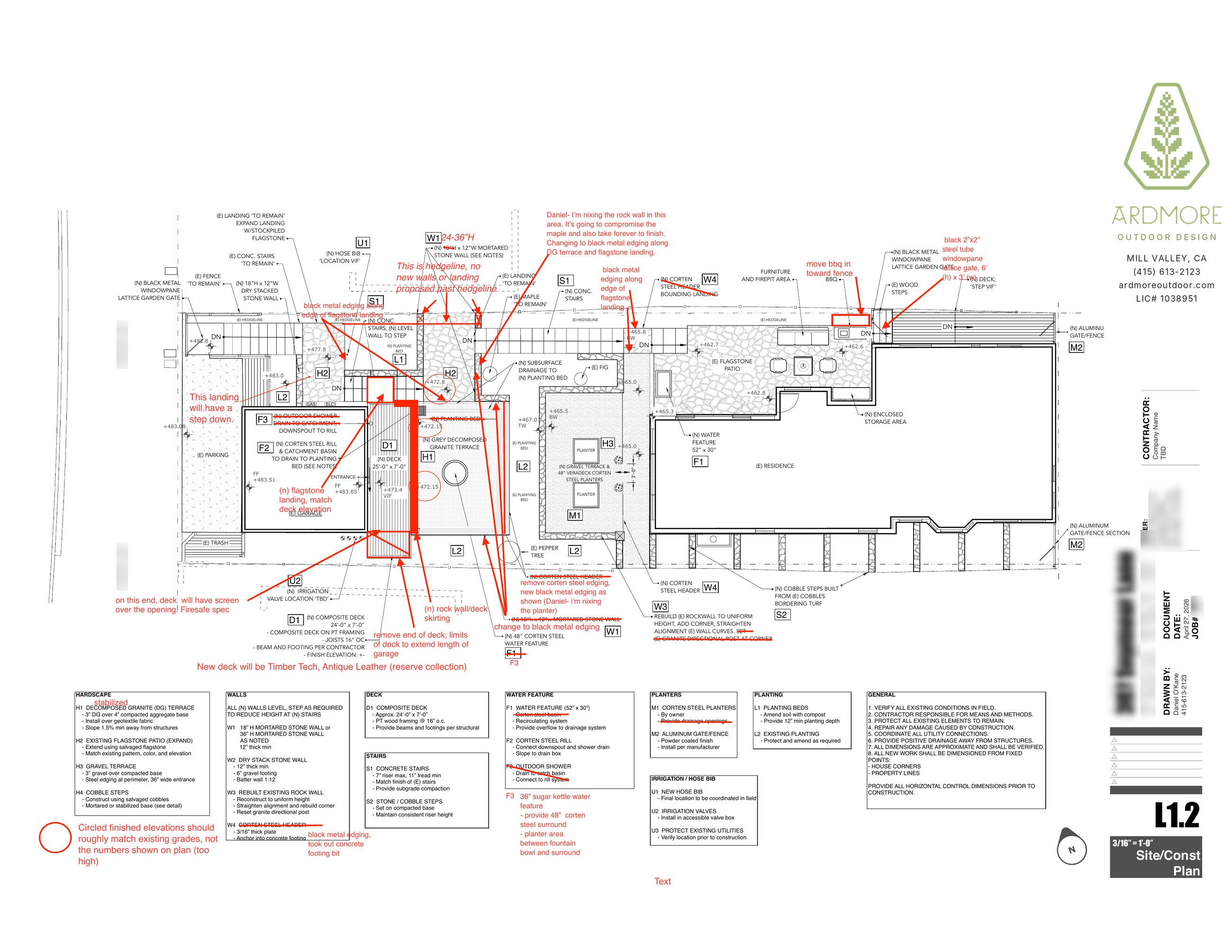
Client redlines on a site and construction plan, logged and resolved in the next revision. Tap to enlarge.
Plans evolve. We provide responsive revisions and coordinate directly with architects, structural engineers, and contractors to keep your project moving.
Share your project details and we'll recommend the right combination of services for your goals and timeline.
Start Your Project